

Snowfall blankets Northwest Montana n Severe driving conditions, accidents, school closures reported throughout region

Several accidents involving trucks were reported over the weekend as severe weather conditions pounded I-90 near Lookout Pass. (Photo courtesy of the Montana Department of Transportation).

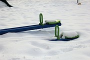
Alberton School was cancelled on Monday due to severe weather conditions involving freezing rain and snow. (Kathleen Woodford/Mineral Independent).

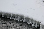
Colder-than-normal conditions are expected to continue in the Northwest according to the National Weather Service. (Kathleen Woodford/Mineral Independent).
A severe winter storm caused havoc in Western Montana oon Monday, but the impact was widely varied.
Schools were closed throughout the Flathead due to historic snowfall in some areas, blowing winds elsewhere, and icy roads throughout the region. There were also school closures in Lincoln County, and Alberton in Mineral County. Sanders County reported two hour delays as the Weather Service predicted over two feet of snow with rain. Blizzard warnings were also in affect for West Glacier and Seeley-Swan Lake Region.
I-90 had reports of snow and ice between Lookout Pass and St. Regis. With freezing rain reported from Tarkio to Alberton. According to the Montana Highway Patrol, 41 traffic incidents were reported over the weekend stretching west of Alberton to Lookout Pass.
Earlier last week, several inches of snow pounded Mineral County, followed by another plunge in temperatures, dipping below zero. Severe weather alerts extended from Friday until Sunday with warnings of snow and freezing rain.
The alerts were on track, when Friday there were reports of two accidents which occurred five miles west of St. Regis on I-90. They were less than two miles apart, and blocked the westbound lanes. In the first crash, two tractor-trailers were involved at about 1 p.m. followed by a tractor-trailer and a vehicle in the second incident about 15 minutes later. Also on Friday, 19 additional accidents were reported, with all but four, occurring after 1 p.m. until midnight
The driving conditions were snowy and severe, according to the Montana Department of Transportation. Chains were required for towing units on Lookout Pass and severe conditions extended for more than 30 miles on either side of the Montana-Idaho border.
On Saturday, the National Weather Service warned of severe driving conditions on I-90 from St. Regis to Lookout Pass. Additional heavy snow continued in the morning with reports of six to 10 inches from Haugan to Lookout Pass. On Saturday afternoon, a snow slide closed at least one lane of I-90 near Lookout Pass. The slide was reported just after noon between Taft and Saltese exits.
Several semi-truck accidents were reported, including one at 7:30 p.m. on Saturday where a truck was reportedly blocking the west bound driving lane near mile marker 1 on Lookout Pass. Also, on Sunday morning at 8:30 a.m. a semi accident blocked the westbound lane near mile marker 66. Further accumulations of 17 to 23 inches were reported on Sunday night through Monday night from Saltese to Lookout Pass.
While residents in the Flathead prepared for blizzard conditions, temperatures warmed up Sunday afternoon and some “ponding” occurred east of Alberton. This is when the snow begin to melt and causes pools of water on the road surface.
“Drivers should be extra-careful, due to changing conditions. People think freezing rain means the temperature is below freezing, but rain can freeze after it hits because the ground has been cold for so long,” said Dan Zumpfe, meteorologist with National Weather Service.
Reports of snowfall were predicted to approach extreme, historic levels going into this week. The extreme weather in Flathead County has been attributed to a nearly perfect setup where a strong, moisture-laden storm met up with an arctic cold front sitting over Glacier National Park. Snowfall predictions were between 10 to 16 inches on Friday and Saturday morning in the area.
Areas north of Highway 200 were warned to prepare for blizzard conditions on Monday with high winds. Superior, Thompson Falls, Seeley Lake and Polson were warned of eight to 18 inches of snow and Lookout Pass was predicted to see another two to three feet.
Meanwhile, if Punxsutawney Phil’s prediction comes true, people need to brace for six more weeks of winter. The famous Pennsylvania groundhog saw his shadow last Thursday on Groundhog Day, which indicates more winter is on its way. Thousands of people gathered for the event in Punxsutawney, Penn. according to a report by the Associated Press. They listened to music, watched fireworks in below freezing temperatures as they awaited Phil’s prediction. Records dating to 1887 show Phil has predicted more winter 103 times while forecasting an early spring 18 times.
Phil’s prediction seems to be in agreement with the National Weather Service, which reports surges of cold in the Northwest and Northern Rockies and colder-than-normal conditions expected through early spring. So far this winter, Montana and northern Idaho have recorded the coldest and snowiest conditions to date in three to four decades.