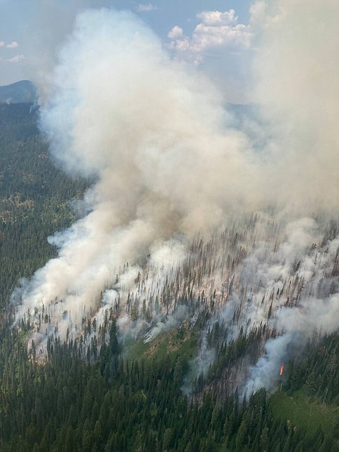
Lolo National Forest road and trail closures on Stateline Complex Fire
The Lolo National Forest has implemented emergency road and trail closures on the Superior Ranger District in response to increased fire activity on the Stateline Complex.
The Stateline Complex is burning on the St. Joe Ranger District of the Idaho Panhandle National Forests, to the south and west of the Idaho-Montana state line, and about 6.5 miles southwest of St. Regis.
Road access to Diamond and Cliff Lakes is now closed due to fire activity. Dry Creek Road 342 remains open for motorized use.
Additionally, a temporary flight restriction remains in effect for the entirety of the Stateline Complex area and several other areas remain closed, including Quartz Creek as well as the following: St. Joe River Road/Highway 50 between Bluff and Bruin Creek; Forest Service Road 1216 from its junction at Highway 218 to its terminus; Gold Flat Campsite (T16N, R30W, Section 23); several trails and areas within the St. Joe Ranger District.
The following roads and trails are closed for public and firefighter safety:
- Diamond Lake Road 7843 is closed from milepost 0.00 at junction with Dry Creek Road 342 to the end of the road;
- Diamond Lake Trail 56 is closed from milepost 0.00 at junction with Diamond Lake Road 7843 to the end of the trail;
- Cliff Lake Trail 100 is closed from milepost 0.00 at junction with Diamond Lake Road 7843 to the end of the trail;
- Dry Creek Divide Trail 203 is closed from milepost 11.94 at junction with Dry Creek Road 342 to the end of the trail.
For more information on the Stateline Complex visit:
Inciweb: https://inciweb.nwcg.gov/incident/7627/
Idaho Panhandle National Forests Facebook: https://www.facebook.com/USFSIPNF
Fire Restriction Information: http://www.idahofireinfo.com/ and https://www.mtfireinfo.org/
Closure Information
Idaho Panhandle National Forests (Idaho): https://www.fs.usda.gov/alerts/ipnf/alerts-notices
Lolo National Forest (Montana): https://www.fs.usda.gov/alerts/lolo/alerts-notices