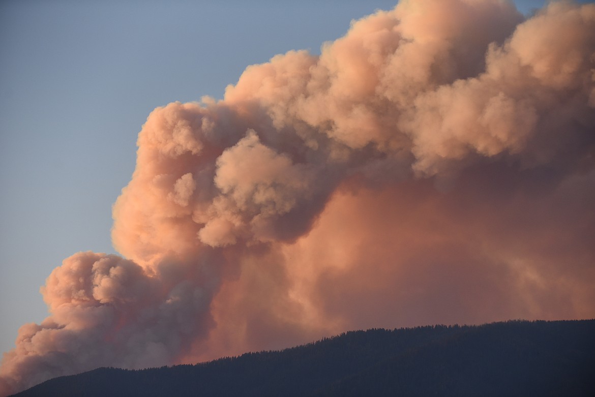
Sheriff's Office orders evacuations for Graves Creek area residents
Sunday, the Sanders County Sheriff's Office ordered evacuations for all residences on the east side of Blue Slide Road in Graves North and Graves South areas due to the growing Thorne Creek Fire.
The fire is now listed at 5,627 acres with no containment.
According to information from West Lolo Complex officials, the areas under the evacuation order are described as “from Cougar Creek south to the intersection of Blue Slide Road and River View Lane.”
County deputes were going to go door-to-door to inform residents in these areas of the evacuation. They reported security measures are in place to protect private property.
Montana Red Cross opened an evacuation center for residents displaced by the Thorne Creek fire burning northeast of Thompson Falls.
The Red Cross evacuation center is located at the Thompson Falls Community Center, 410 Golf St.
Residents who check in there will have access to services including a safe place to stay, meals and other community resources. All Red Cross services are free.
Families also can request Red Cross services by calling 800-272-6668.
People were also offering assistance for those who may displaced, including those with livestock, on Facebook page Sanders County 411.
Also, new pre-evacuation warnings went into effect Monday for the Harlow and Ashley areas.
In terms of firefighting operations, Operations Section Chief Andy James said during a Saturday briefing, that aerial crews did ignition work Friday on the north end of Winniemuck Creek to keep the fire from making big runs north and throwing out spot fires.
“Also, the fire did grow several hundred acres Friday, but some of it burned back on itself, which is good news,” James said.
He also said fire officials were talking to landowners on Thompson River Road and the community of Snider and informing people on what control operations would be, including building lines and hose lays. There are also a number of Forest Service campgrounds in the area.
James also said there were plans to wrap the Priscilla Mountain Lookout, located east of the fire.
The cabin, built in 1929, was used for emergencies into the 1970s. The structure is a rare, 14-square foot cabin with a gable roof and cupola, one of only three in the Forest Service’s Northern Region and eligible for listing on the National Register of Historic Places.
“It’s has great value to the Forest,” James said.
Also, according to fire officials, firefighting crews continued to build indirect control lines with heavy equipment task forces and were constantly monitoring fire behavior and movement.
Hoses, pumps, and water handling equipment are in place on the fireline and around structures and are ready to be charged and deployed as needed.
Fire officials said firefighting crews have established an anchor point at Graves Creek. The location is a barrier to fire spread where they will continue building and securing fireline.
The anchor point is used to minimize the chance of being flanked by the fire while the line is being constructed. Air resources, in the form of helicopters dropping buckets of water, will be utilized as necessary to support firefighting on the ground.
It is important for the public to understand that without “boots on the ground” to guide aircraft and follow up with hand and tool work, dropping water or retardant is not effective, as it will just dry up.
Due to the limited number of resources available for fire suppression regionally and nationally, fire managers are sharing resources between incidents and even between divisions. Some firefighters in Division Zulu will move south to reposition in Division November after they finish prepping lines to Weber Gulch Trailhead. A swing shift of crews has been added to the plan and were to be briefed last Saturday.
Fire managers said people should expect to see more smoke as indirect, burnout tactics are implemented this week. Burnout operations, like all fire suppression activities, involve high risk. Fire managers weigh these risks very carefully with firefighter and public safety always at the forefront their critical decisions. As the Thorne Creek Fire is burning in rocky, steep terrain, with heavy downed timber, it is currently inaccessible to firefighters for direct engagement, and it is much safer to continue indirect tactics.
On the Stateline Complex, located on the Montana-Idaho border, about 6 1/2 miles southwest of St. Regis, firefighters anticipated similar fire behavior as earlier in the weekend with consistent spread in dead fuels with potential for upslope pushes when topography and fuels align.
Smoke from this Complex as well as fires burning to the west will continue to be visible to the surrounding area. Crews continue to utilize direct, indirect tactics across the Complex.
The National Weather Service is calling for daytime high temperatures to be in the mid to upper 90s with low humidity.
Closures and Additional Information:
Stage 2 fire restrictions are in effect; visit www.mtfireinfo.org to learn more about local fire restrictions.
Air quality and smoke monitoring can be found at fires.airfire.org/outlooks/WestMontana.
Area, road, and trail closures are issued for areas impacted by fire on the Lolo National Forest. Closure information can be found at inciweb.nwcg.gov/incident/7620/
Temporary flight restrictions are in place over the Thorne Creek Fire. If you fly, we can’t! Visit knowbeforeyoufly.org
Sanders County Wildland Fire Information Facebook: @SCWildlandFireMT.
Idaho Panhandle National Forests Facebook: https://www.facebook.com/USFSIPNF